Along the bike route of the Adige, the section between Verona and the border with Trentino at Borghetto used to be one of the least cyclable, but now with the creation of a dedicated bike path between Chievo and Rivoli Veronese, this section can be traveled without too many problems trying to coexist with motorized traffic.
Point of departure is the train station of Verona Porta Nuova. Upon leaving the station head towards Chievo, a suburb of Verona to the north. One possible route has been recorded in the GPS trace of the route.
At Chievo, once you have gone through the piazza with the church [Piazza Chievo], there is a sign for a bike route which directs you to the dam and bridge over the Adige river. Don’t follow this route because it would take you across the river; it is necessary instead to turn left onto the principal road to Bussolengo (Via Aeroporto Angelo Berardi, then via Turbina). The road is narrow and quite busy with traffic and therefore requires much attention.
After little more than a kilometer [.8 mile to be precise] you cross over a canal and immediately on the other side you will find the beginning of the bike path. This is a path that follows alongside the canal, in a long straight section as far as Bussolengo where the cyclist is directed away from the canal and needs to ride through the center of town.
Within Bussolengo it is easy to lose track of the route, as happened to yours truly: once you have gone through Piazza della Vittoria you come to a fork; the street to the right drops you in a steep descent to the Adige. This is not the best choice; it is better to take the street to the left (Lungomonte Graziani), or backtrack to Via Roma just south of the piazza, which in about 500 m/1600 feet leads you back to the bike path along the canal. The GPS trace already mentioned above, describes an alternate route along the Adige River which descends steeply onto a small road open to traffic, which after about 5 km/3 miles brings you back, with a slight climb, up to the bike path along the canal.
The bike path continues completely flat following along the canal, which maintains its horizontality thanks to a series of rather unusual viaducts; the canal, and all its water, flows above houses, roads and trees.
This easy stretch of the bike path ends abruptly in front of a mountain wall through which the canal passes, but not the cyclist, who now must leave the canal and go up an ascent rated at 10%, but which actually is not so difficult if one is accustomed to mountain biking. The bike path is narrow and requires one to be careful: you may find yourself suddenly in front of one or more cyclists who are coming down at high speed. You arrive at the high point which is 220 m/720 feet. The descent takes you down to Rivoli Veronese and provides sweeping views of the Adige valley and the Wohlgemuth fortress.
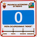
Once past Rivoli you quickly will find yourself back on the bike path which concludes in the locality of Canale, where it leads onto a local road with very little traffic. You can continue along this road and suddenly you will find yourself yet again along the canal that now has emerged from the mountain, and after a large bend to the right you will come to Borghetto, at the border between Veneto and Trentino. Here is the starting point (or if coming from the north, the end point) of the section of bike path within the province of Trento.
From here on, there are no particular difficulties: the route runs along the Adige to Avio, Ala and Rovereto where this bike route ends.
The stretch from Trento to Borghetto is described on another page.
